
Huntsville ZIP Code Coverage
Official Texas and USPS material identifies eight Huntsville postal ZIP entries. The coverage terms below are intentionally cautious. Official pages confirmed the postal city and routing relationships, but did not provide residential boundary polygons or station names beyond the Huntsville postal label. A ZIP code directory is most useful when it preserves that uncertainty instead of inventing neighborhood edges.
| ZIP | Areas covered or postal use | Post office label | Research note |
|---|---|---|---|
| 77320 | Standard Huntsville delivery area | Huntsville postal city | USPS pairs it with 77340 routing |
| 77340 | Standard street-delivery area | Huntsville postal city | Used by city, library, and CAD addresses |
| 77341 | Unique or institutional routing | Huntsville postal city | State file confirms the city label; footprint was not verified |
| 77342 | PO Box or unique routing | Huntsville postal city | Exact box station was not identified |
| 77343 | Unique or institutional routing | Huntsville postal city | Exact facility was not exposed |
| 77344 | Unique or institutional routing | Huntsville postal city | Exact facility was not exposed |
| 77348 | Unique or institutional routing | Huntsville postal city | Exact facility was not exposed |
| 77349 | Unique, institutional, or standard routing entry | Huntsville postal city | USPS identifies Huntsville routing; address class needs confirmation |
The Huntsville ZIP code directory therefore distinguishes the standard street entries from unique or PO Box routing. A postal name is not a neighborhood name, and it does not by itself identify a city-limit parcel.
Verify Huntsville ZIP Codes First
Use a USPS address check before writing down a ZIP code from a deed, directory, or mailing label. The federal USPS routing bulletin documents the Huntsville routing pairs that support the local postal table. It does not replace an address-specific lookup, so retain the standardized address and the date checked. This matters when an older source uses a postal label that has changed or has no ZIP at all.
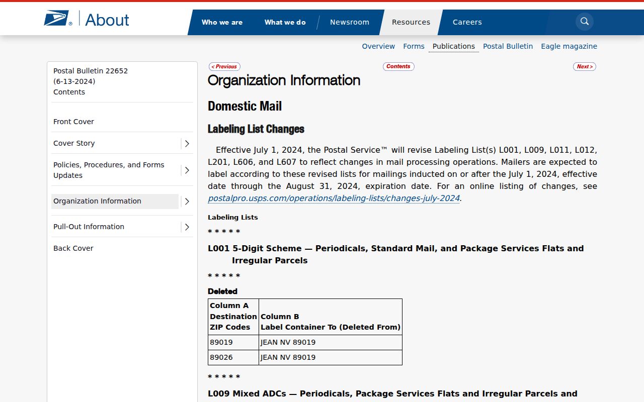
Postal routing describes delivery, while the deed and appraisal records describe a property through identifiers such as lot, block, abstract, and parcel number.
Note: Keep the source date beside a ZIP code because a current delivery label should not be projected onto a historical directory or deed without checking it.
Search a Huntsville ZIP by Address
The Huntsville ZIP code directory does not turn into a ZIP-wide resident list. Walker CAD’s public form has no dedicated ZIP field in its documented default search. It accepts an owner name, street number, street name, property ID, geographic ID, subdivision, neighborhood, and related fields. Search the known street address after USPS verification, then compare the CAD situs and mailing fields. If a detailed street search misses, the CAD instructions recommend the street name alone or another parcel field.
- Verify the exact street address and ZIP with USPS, then save the standardized city, state, and postal code.
- Search the street number and street name in Walker CAD. Compare the situs, mailing address, property ID, and legal description.
- Open the Walker CAD Interactive Map to check parcel position and city or county context. Its map is approximate, not a survey.
- For one known voter only, use the state portal to confirm personal registration details. Do not treat that result as a list of ZIP residents.
Once the address is narrowed to a street, the Huntsville street directory has the fuller by-address records chain. The ZIP step is a postal filter, not a substitute for parcel research.
Huntsville ZIPs Need Parcel IDs
Walker CAD separates the situs address from the tax mailing address. The situs is the mapped, taxable property location, while the mailing address is where notices are sent. Either one can contain a ZIP code, but they answer different questions. A mailing ZIP can point to a trust, agent, former address, or owner outside Walker County. It does not establish the postal ZIP for the property itself or show who occupies it.
Use the property ID, geographic ID, map ID, and legal description with the street address. A legal description may use a subdivision, section, block, lot, abstract, or acreage. Those identifiers stay useful when an older deed, census, or directory uses a different street spelling or no ZIP at all. In Huntsville, the documented CAD sample cards also distinguish owner ID, ownership percentage, exemptions caveat, taxing jurisdictions, and annual roll history. Each field is a parcel clue, not a broad ZIP resident search.
The postal name, the county parcel label, and the 911 emergency address can differ without one being wrong. Save the source and date next to each claim so a modern mailing ZIP is not confused with a historic legal location.
Huntsville ZIPs in Old Records
Historical directories, census schedules, and deed books need a different approach from modern postal work. Reverse directories use street number and name, and their printed year may predate the ZIP code or reflect a prior postal label. Only 1975 and 1990 Huntsville city-directory entries were identified in the captured Texas State Library material, while exact local reverse-directory years still need confirmation at the library, SHSU, or FamilySearch.
Start with the address as written in the historical source. Then test number and street variants against a subdivision, abstract, lot and block, deed book and page, or parcel and GEO ID. This preserves the distinction between a dated address record and a present-day ZIP code directory, especially where city limits, rural roads, or postal labels have shifted.
Huntsville ZIPs in Voter Self-Checks
Texas My Voter Portal uses a ZIP code as one part of a known voter’s own registration check. It does not browse everyone in 77320 or 77340. The state guide documents name mode with first name, last name, county, date of birth, and ZIP, plus separate VUID and Texas driver-license routes. Select Walker County for a Huntsville registration record, and use the public self-check only for its stated purpose.
| Field or mode | Entry type | Use in the state portal |
|---|---|---|
| First and last name | Text | Required in name mode |
| County | Selection | Required in name mode; select Walker |
| Date of birth | Date | Required in name mode |
| ZIP code | Text | Used to display registration information |
| VUID or Texas driver license | Text | Separate self-lookup routes where applicable |
The VoteTexas portal is shown in the captured state reference. A match may show a status, VUID, county, precinct, polling place, and district information, but ballot choices never appear.
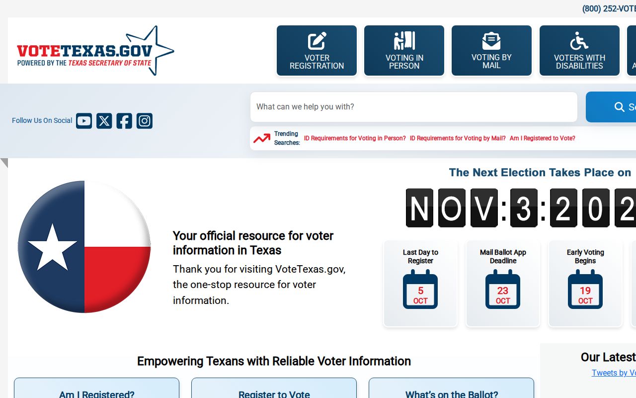
Texas Election Code confidentiality rules protect sensitive identifiers and protected addresses, so a ZIP is a disambiguator for an individual rather than a public address filter.
The Secretary of State’s Walker County voter-history table provides countywide registration figures, not ZIP-level or Huntsville-only totals.
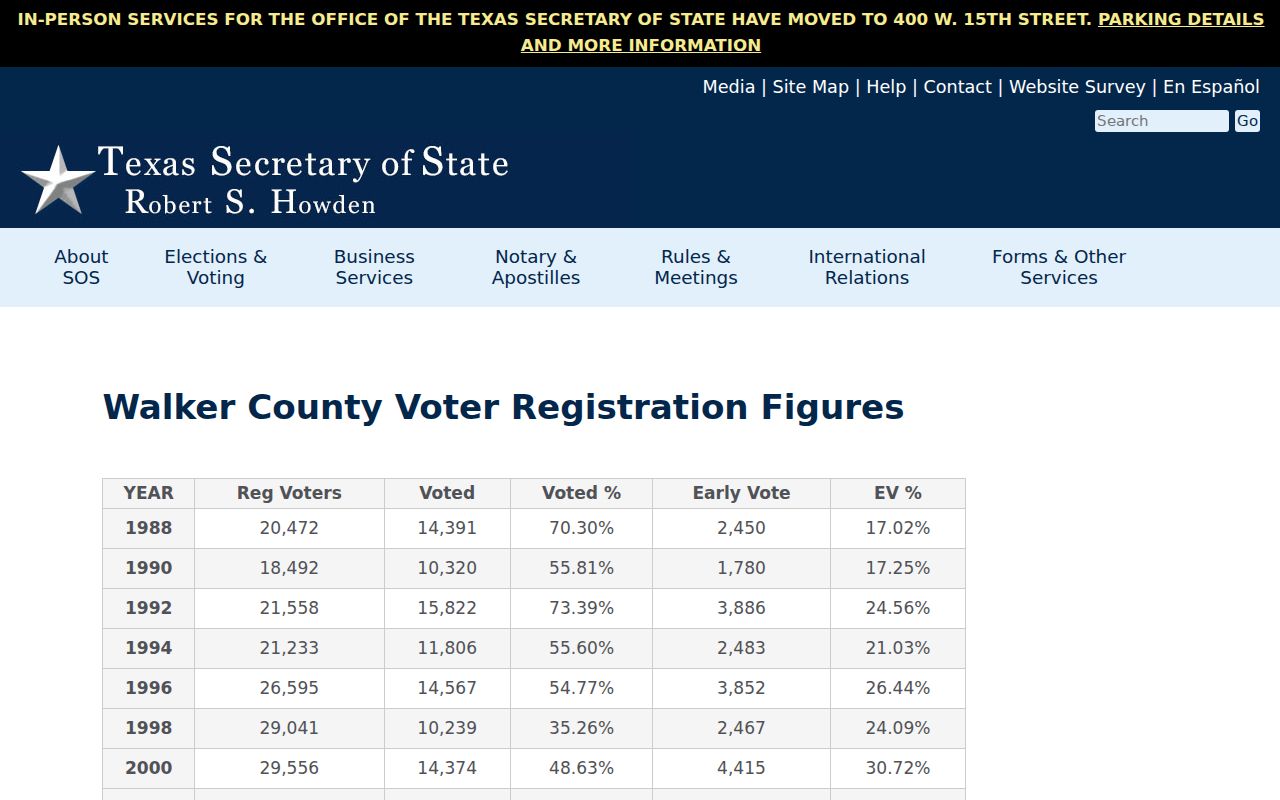
Use that historical context carefully, because a countywide total cannot establish how many people reside in a particular postal route.
Huntsville ZIP Code Routing Quirk
Huntsville’s standard street-delivery ZIPs sit alongside university, Texas Department of Criminal Justice, and PO Box routing entries. That mix is a local records quirk. A ZIP can label a large institutional delivery route without identifying a neighborhood, a residential parcel, or a person’s location. The state postal-code file confirms the city label for 77340 through 77344, while official postal data also identifies 77348 and 77349 as Huntsville routing.
The Census QuickFacts reference for Huntsville supplies geographic context, but census geography and delivery ZIP geography are separate systems.
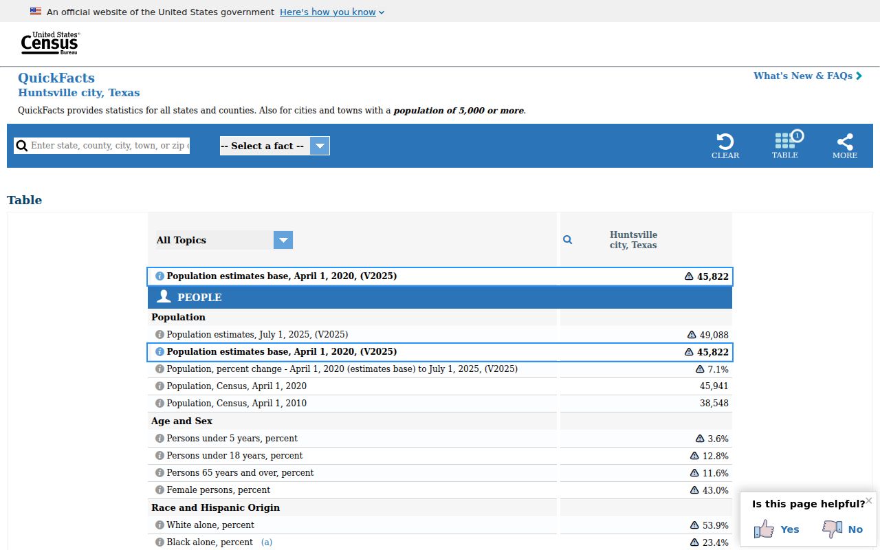
Use the parcel’s legal description and the relevant city or county record when a postal label and a geographic boundary point in different directions.
Huntsville ZIP Codes and City Limits
ZIP boundaries are USPS delivery geographies, not municipal limits, voting precincts, or appraisal jurisdictions. A Huntsville ZIP can serve county land outside city limits, while a Walker County parcel can use another postal city. CAD is parcel-keyed, and the captured GIS information is parcel-keyed too. The county’s 911 procedure adds another address system based on road side, distance, nearby posted numbers, GEO ID, and GPS.
Address mismatch. A postal ZIP, a CAD situs, and a 911 address can all be valid for their separate purposes. Verify the source needed for the question at hand.
- ZIP and ZIP+4
- A ZIP identifies a postal delivery area. ZIP+4 adds a smaller delivery segment, not a legal parcel boundary.
- PO Box ZIP
- A postal code used for box or specialized routing. It does not establish a street location.
- Unique ZIP
- A code used for a particular institution or large delivery operation rather than a general neighborhood.
- Carrier route
- A postal delivery sequence used to move mail. It is not a resident roll or city boundary.
Huntsville ZIPs Meet 911 Addressing
Walker County Planning and Development’s 911 Address Request Form shows why an address is more than a mail label. Its field process records the road or driveway connection, side of the road, GEO ID, land description, physical entrance, distance from the road start, nearby posted numbers, and GPS coordinates. That method is especially useful when rural, new, or changed addresses do not match an older record cleanly.
For a historic source, search the street spelling and number as written, then bridge the result with subdivision, abstract, lot and block, deed book and page, or parcel and GEO ID. A modern ZIP code directory cannot repair an old address by itself, but it can keep the postal step separate from the legal-property trail.