
Tracing Residents Along Huntsville Streets
A Huntsville street directory is a sequence of address-keyed sources, not a single roll. Walker CAD can identify the parcel that uses the address and the owner attached to the tax account. The map helps locate nearby parcel IDs. The Clerk’s recorded documents connect a legal description to past grantors and grantees. Dated directories, census, permits, and obituaries can add an occupant or household lead. Each source has a different date and purpose, so a name should be labeled as owner, listed occupant, subscriber, or case party rather than simply called a resident.
Start with the full address as currently used. If the address does not return a result, use the street name alone, the subdivision, or a property ID. Keep the situs address separate from the tax-mailing address. The mailing field may belong to an owner, a trust, an agent, or an out-of-town recipient. It is a useful contact clue, but it does not prove who is inside a Huntsville address today.
- Enter the street number and street name in Walker CAD. Record the property ID, geographic ID, situs, owner, mailing address, subdivision, and legal description.
- Open the Walker CAD interactive map and select the target parcel and touching parcels. Use the map for context, then return to CAD for the record detail.
- Search the current owner as a grantee in Official Records, then search the seller as an earlier grantee. Keep grantor and grantee roles distinct.
- Ask Development Services or the City Secretary for existing address-based permits, code matters, or inspection records if the needed material has no public search page.
- For an older household, check library and archive directories, census sources, tax rolls, and microfilm. Mark each result as a dated listing, not a claim of continuous occupancy.
Note: A parcel chain can establish title history, while an address listing supplies a separate and time-limited clue about a household.
Huntsville Street Directory Fields at CAD
Walker CAD’s property search accepts more than a street name. Its visible fields include Owner Name, Street Number, Street Name, Property ID, Owner ID, Geographic ID, Abstract, Subdivision, Neighborhood, Property Type, Tax Year, and advanced protest-related fields. The site says to omit prefix, suffix, and unit information from the street-name field. When an address search stalls, reduce the query to the street name or use a stable property key from an earlier result.
| Search field | Street-directory use |
|---|---|
| Street Number | Narrows a query to a particular frontage or parcel address. |
| Street Name | Supports a manual browse of a Huntsville street without prefixes, suffixes, or unit numbers. |
| Property ID / Geographic ID | Preserves the parcel key for map comparison and later record checks. |
| Subdivision / Abstract / Neighborhood | Bridges an address to the legal land description used in deeds and plats. |
The Walker CAD sample parcel card shows the kind of detail available after a match: situs, map ID, legal description, owner ID, mailing address, values, taxing entities, and privacy-limited exemption display.
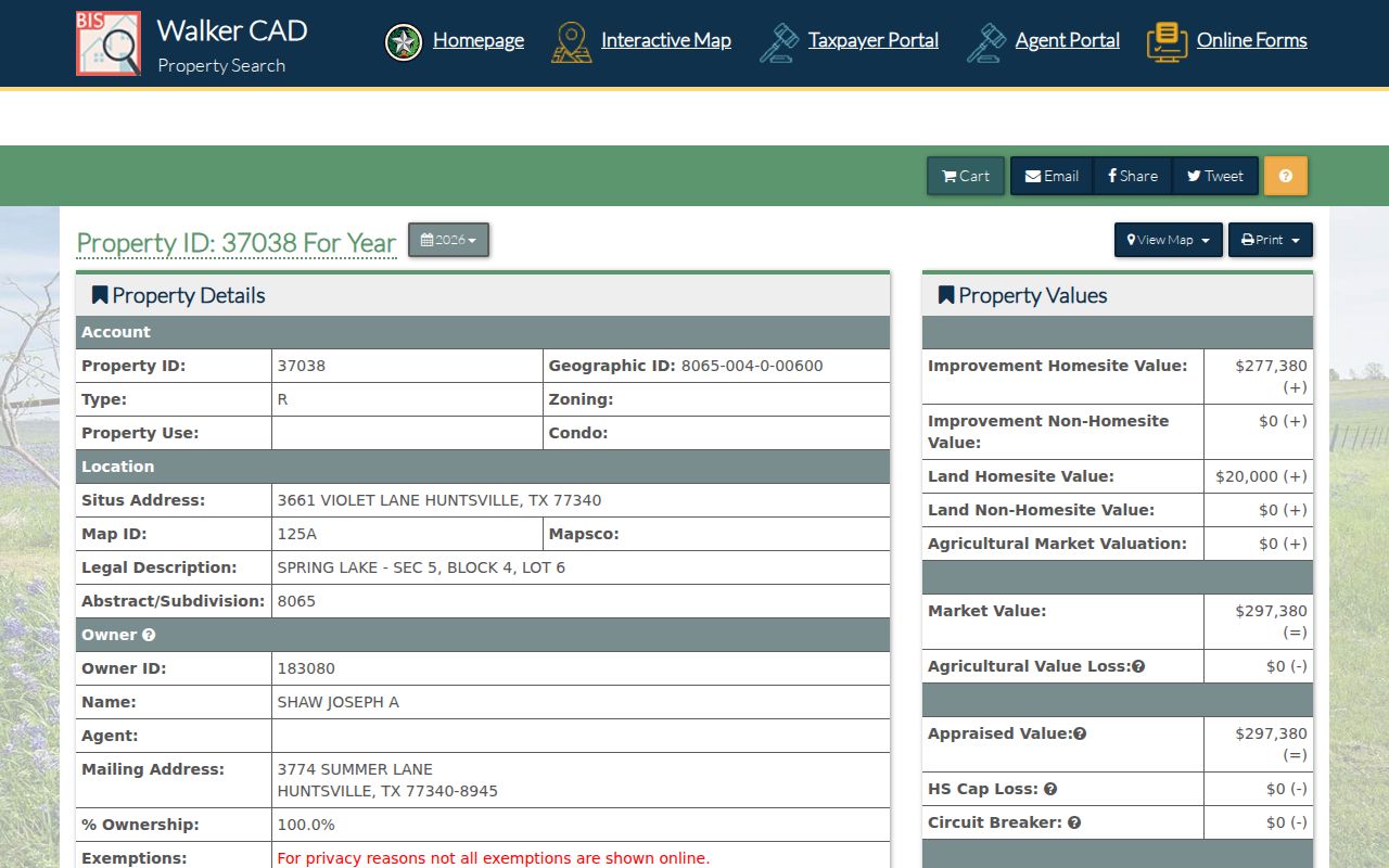
The parcel-card view turns a street address into a repeatable property record, but it does not enumerate every person at that address.
- Parcel
- A defined tract of taxable land, tracked in CAD by a property or geographic ID.
- Situs address
- The mapped physical property address used for the appraisal record, distinct from a tax-mailing address.
- Plat
- A recorded map that links subdivision lots, blocks, roads, and other legal land references.
- Criss-cross directory
- An address-first directory that can identify a dated listed occupant or subscriber, not necessarily an owner.
Huntsville Street Parcels on the CAD Map
The Walker CAD Interactive Map is the visual part of the street directory process. Select the target parcel, zoom along the street segment, and click nearby polygons to capture parcel IDs. The official CAD material identifies parcel and abstract layers and warns that map boundaries are approximate, not surveys or legal boundary evidence. Use the map to find possible adjacent parcels, not to decide a title line.
Live text inspection did not expose a complete list of map controls, search fields, or radius tools. That is a reason to avoid promising a map feature that has not been verified. For legal boundaries, return to the Clerk’s plat or deed and use the recorded lot, block, subdivision, abstract, book, page, or legal description. The map gives orientation; the recorded document gives the legal trail.
Huntsville Deeds Follow a Street by Legal Description
Walker County Official Records is where a street lead becomes a document trail. The quick search accepts grantor or grantee, subdivision, document type, document number, date range, and index-only or OCR mode. The advanced page adds Party Names, recorded and instrument date ranges, book, volume, page, lot, block, legal description, and document-image phrase. Search current ownership as a grantee, identify the seller, then search that seller as a prior grantee.
Street text can disappear in older instruments. A lot and block, subdivision, abstract, or book and page may be more reliable than a road name. Record deed date and recording date separately. When a trust, estate, corporation, or “et al.” appears, search that name and check associated releases, probate, heirship, or plat records before deciding the chain ends.
The Clerk’s quick-records search is the source shown in the next image. Its index is useful for names and instrument paths, while image access and older coverage should be confirmed with the Clerk.
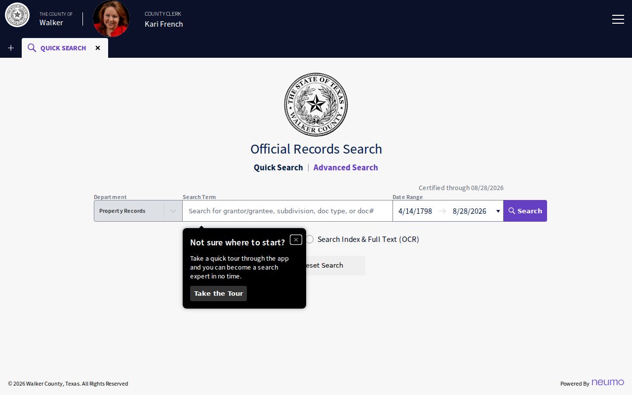
The quick-search screen shows the practical bridge from a parcel owner to recorded grantor, grantee, subdivision, and document-number research.
Huntsville Addresses Follow 911 Field Rules
Walker County Planning and Development’s 911 Address Request Form explains why an address can change or fail to match an older description. The form records the road or driveway connection, side of the street, GEO ID, land description, physical house or entrance description, distance from the road’s beginning, nearest posted numbers, and GPS coordinates. The county assigns the emergency-service address through those field checks, not only through a mailing label.
For a rural or newly assigned address, retain the legal description and parcel key beside the street number. A ZIP, postal city, or current road label may not match a historic deed. The Planning and Development route is at 1313 University Avenue, Suite A, Huntsville, with a written form and phone fallback, so an address question can be directed to the office that assigns it.
Huntsville Address Records by Street
Different address records illuminate different parts of a Huntsville street. CAD identifies a taxable parcel and its owner field. GIS shows parcel context. Clerk records contain title instruments. Planning and Development may hold address-based permit or code material. A dated directory can identify a listed occupant or subscriber. Voter data has tight legal limits and the public portal is an individual self-check rather than a public block browse.
| Record Set | Keeper | What It Shows | Access |
|---|---|---|---|
| Appraisal parcel card | Walker CAD | Owner, situs, mailing address, legal description, values, and roll history | Public search; counter or PIA fallback |
| GIS parcel view | Walker CAD / BIS | Parcel shapes, IDs, road context, and abstract layer | Interactive map; approximate map evidence |
| Deeds, plats, and liens | Walker County Clerk | Grantor, grantee, dates, legal description, book/page, or document number | Public index, counter request, or microfilm |
| Permit or code record | Huntsville Development Services | Dated work, case, or inspection activity where releasable | Department contact or PIA; no public index found |
| Historical address listing | HPL, TSLAC, SHSU, or FamilySearch | Listed occupant, subscriber, spouse, occupation, or address | On-site/archive route; local reverse years unverified |
The property ID, geographic ID, subdivision, or legal description ties CAD to the Clerk’s records more reliably than a street label alone. For a specific current person, use the authorized self-lookup or ask the elections office about lawful voter-file access. Do not turn one registration result into a claim about all households on a Huntsville street.
Huntsville Permits Add Dates, Not Title
Huntsville Development Services is the address-based fallback for permits, code enforcement, planning, health inspections, and central inspections. The department lists permits at 936-294-5700, Central Inspections at 936-294-5717, Code Enforcement at 936-294-5793, Health Inspections at 936-294-5771, and Planning at 936-294-5782. No public permit or code search interface was located in the official material. Ask for existing records by address and date range, specifying a permit number, description, applicant or owner field, issue date, final date, or inspection status where relevant.
Huntsville Development Services’ directory is the official contact source for this request path. A permit can date work at a parcel, but it does not prove a sale, current occupancy, or the complete history of a building.
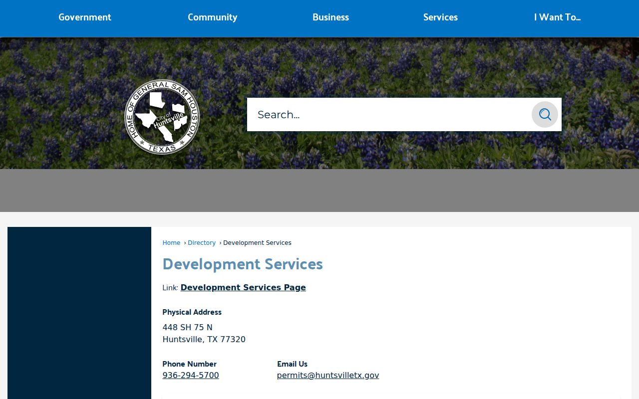
The city contact view provides the direct department paths needed when a street address has a records question but no searchable city database.
Note: Request existing address records from the custodian, because a Texas public-information request does not require an office to create a new report.
Huntsville Street Listings from Older Directories
A reverse or criss-cross directory begins with an address, then points to a listed subscriber or occupant. It is useful when an old Huntsville street number is the only starting detail. Confirm any result in the alphabetical section, then compare it with a deed, tax roll, census, obituary, probate record, or permit. A directory can omit a person with an unlisted telephone, a recent move, a student, a renter, or a household that did not participate.
The confirmed Texas State Library holdings name Huntsville volumes for 1975 and 1990, but no official source in this research established local reverse-directory years or a publisher for those entries. Ask the Huntsville Public Library, SHSU, FamilySearch, or TSLAC to check specific street spellings and address sections. Historical collections belong to the Huntsville city directories page; here they function as one dated address tool in a street search.
Huntsville Deed Books Continue on Microfilm
When a portal does not reach a needed period, Walker County’s state-library microfilm guide identifies deed records from 1846 through 1886. The records include an index and deed volumes A, A2, B2, C through I, then K through Z and 1. The guide explicitly states that there was no Volume J. This prevents a street-directory searcher from mistaking an archival filing quirk for a missing owner or lost instrument.
Older street continuity often relies on a legal description rather than today’s number. Pair the deed book with tax rolls, which the guide lists from 1846 through 1910, and with historical maps or directories when available. The chain should show what the document says, not assume that a modern address was used in the nineteenth-century record.
Huntsville Street Directory Limits
A Huntsville street directory cannot identify every person who lives at an address. CAD identifies taxable ownership, not a household census. A mailing address can be outside the city, and a homestead signal is not conclusive occupancy proof. Renters, household members, unlisted subscribers, students, short-term occupants, and people with protected records may not appear in the sources used here. Utility customer lists and delivery routes are not public resident sources, and motor-vehicle personal information is restricted by the federal DPPA.
Texas voter self-lookup is not a public map of a block. Protected voter records, Address Confidentiality Program participants, sealed court matters, and restricted vital records are meant to break an otherwise tempting search trail. A missing record does not establish that someone never lived on the street. It only shows that this particular source did not produce a releasable match.
Lawful use. Huntsville street records support personal, civic, family-history, and property research. Do not use an address or name to stalk, harass, threaten, or harm another person; Texas law prohibits that conduct.